Tradd Street Redan


Charleston was a small, defenseless settlement when King William III declared war on France in 1689, and the inhabitants feared for their safety. The earliest surviving legislative discussion of fortifying the nascent port town commenced in the autumn of 1695 and continued into the following spring, motivated by the ongoing French war and a persistent fear of marauding pirates. The legislature’s 1696 plan to build a permanent waterfront fortress, flanked by militiamen “arrayd for battle,” was later substantially revised, but it forms a significant chapter in the physical evolution of South Carolina’s colonial capital.

Before we launch into the story of planning Charleston’s first permanent fortifications in the mid-1690s, let’s review the state of defenses in early Charleston. South Carolina’s provincial government was responsible for erecting and maintaining all of the defensive works built in and around the colonial capital between the 1680s and the 1780s, using tax revenue collected from the inhabitants. I’ve spent the past fifteen years pouring over the surviving government records from this era and collecting information in an effort to construct a narrative of this century-long story. The urban fortifications built in the 1680s and 1690s literally formed the foundations of later works, but the paucity of extant documents from those years makes it very difficult to understand the early landscape. In order to make sense of the surviving scraps of information, therefore, I believe it’s very important to understand the larger context in which they were created, and the continuity of the story over a longer trajectory of history.

An excerpt of South Carolina's "wharf wall" act of March 1696 (Act No. 131), from the engrossed manuscript held at the South Carolina Department of Archives and History.

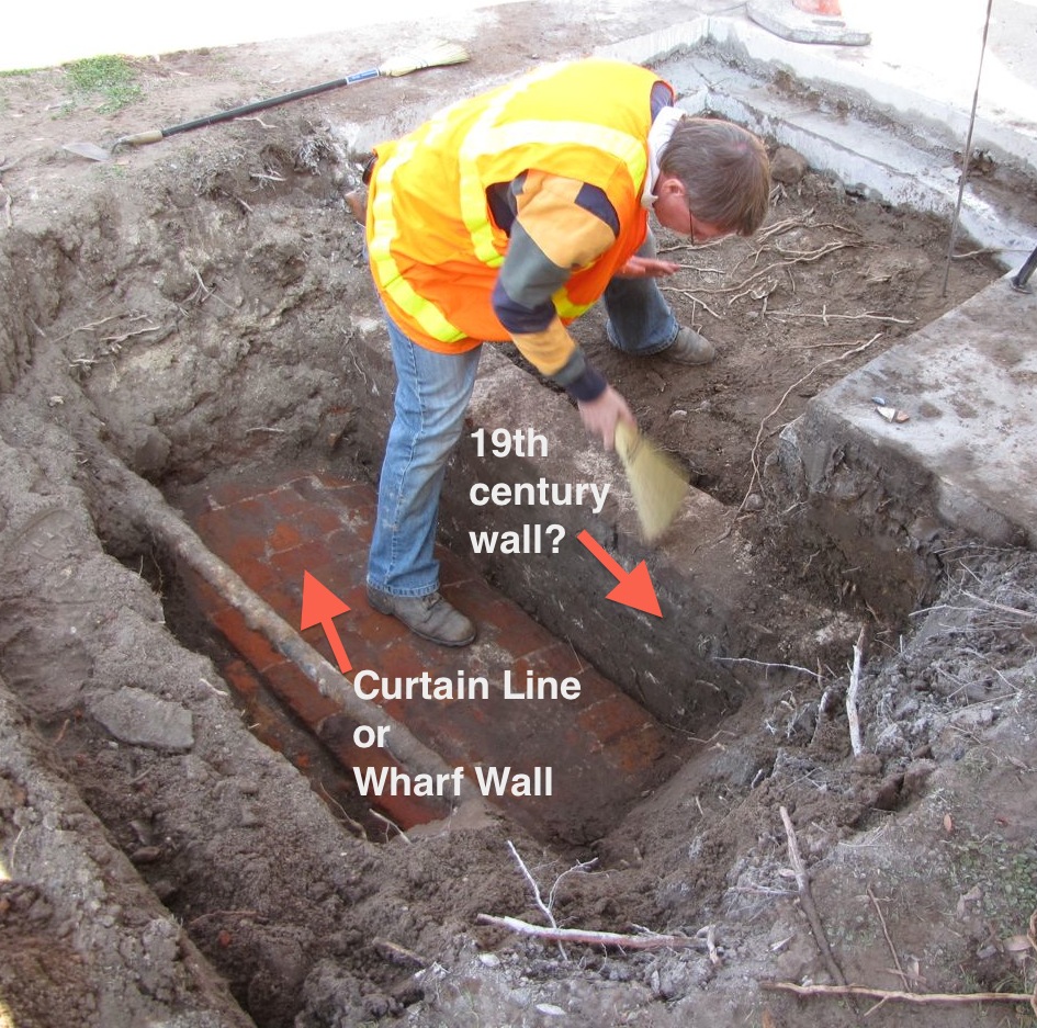
An excerpt of South Carolina’s “wharf wall” act of March 1696 (Act No. 131), from the engrossed manuscript held at the South Carolina Department of Archives and History.

The removal of South Carolina’s colonial capital, Charles Town (now Charleston), from Albemarle Point to Oyster Point in 1680 was undoubtedly accompanied by some discussion of defensive fortifications. The original settlers at Albemarle Point had constructed some temporary fortifications shortly after their arrival in 1670, and the government ostensibly planned to do the same at the capital’s new location. As Maurice Mathews described in a letter written in May 1680, the settlers at new Charles Town intended “to make fortifications when wee have brought our great guns from the old town whereby wee shall be able to deale with the greatest force of ane enemy that can on a sudden come upon us from [the] sea.”[1]

In the ensuing weeks, months, and years, however, there are precious few surviving documents to inform us what sort of fortifications—if any—were actually built, and when and where the cannon were mounted. In fact, the surviving evidence seems to indicate that the people of Charles Town in the 1680s continued to pursue various private interests while ignoring their collective defense. Houses were built, trade networks were established, and plantations carved out of the native wilderness. News of a Spanish force supposedly marching toward Charles Town in August 1682 inspired the Grand Council of South Carolina to order the immediate removal of twenty cannon from the “place where the town was first designed to be made” to the new town.[2] When that intelligence proved false, however, the inhabitants of Charles Town returned to their private interests and, for the remainder of the decade, ignored their defensive needs. The false alarm of 1682 apparently spurred the local government to transport eleven cannon (not twenty) from Albemarle Point to the new town site on Oyster Point, but those iron tubes apparently languished in the sand for more than a decade.

Shortly after his arrival in Charles Town in the spring of 1686, the Huguenot immigrant Jean Boyd wrote a detailed letter to his family back in England about his new home. The surviving copy of Boyd’s letter includes a small, hand-drawn map of the town—the earliest known illustration of urban Charleston in its infancy. As described in an earlier essay (see Episode No. 98), Boyd’s map, ostensibly dated 1686, depicts a connected series of rudimentary fortifications along the town’s first wharf now known as East Bay Street. Nothing is known about the chronology or the nature of these fortifications, however, owing to the loss of South Carolina’s legislative records from this era. 

The Spanish invasion of the southern coast of South Carolina in the autumn of 1686 caused a panic in Charleston, but the political paralysis that accompanied Governor James Colleton’s administration prevented the community from making any real defensive preparations in 1687. Then the flight of King James II from England in late 1688 and the ascension of King William III in early 1689 triggered a new war between England and France, called King William’s War in North America. Among the English colonies, most of the action in that nine-year conflict was confined to areas adjacent to French settlements; that is, from New York to Massachusetts and parts of the Caribbean. South Carolinians of that era were certainly wary of a French invasion, but the threat of a direct assault remained low. Governor James Colleton’s reckless decision to proclaim martial law in South Carolina in February 1690 inflamed local anxieties, however, and ultimately led to his downfall.[3]

Although there was no standing parliament or legislature in South Carolina in the spring of 1690, the citizens of Charleston apparently rallied to create some sort of emergency defenses along the Cooper River waterfront. Our only knowledge of this activity stems from one sentence within a letter written in late April 1690. John Stewart, a Scotsman residing in Charleston, described to a friend back in Edinburgh the latest news from the West Indies and the state of affairs in the Carolina capital: “We expect every day to be atackt by the French corsairs and we ar about to fortifye the whole front of the town like Mr. Smith’s pallisaded breistwork [breastwork] adjoyning to his wharfe.”[4] The extent and nature of such defensive works ostensibly erected along the “front of the town” in 1690 are completely unknown, as they are not mentioned in any other known documents. It is possible, however, that they were continued and improved during the brief administration of colonial South Carolina’s most notorious governor.

This story continues at the Charleston Time Machine.


[1] Samuel G. Stoney, ed., “A Contemporary view of Carolina in 1680,” South Carolina Historical Magazine 55 (July 1954): 153–54. The original source of this item is a “Coppie of a Letter from Charles Towne in Carolina,” located at Edinburgh University Library, Special Collections, Laing Collection, La. II, 718/1. Throughout this essay, I have reproduced the original spellings and misspellings found in the primary sources here cited.

[2] Letter from Thomas Newe to his father, dated 23 August 1682, in Alexander S. Salley Jr., ed., Narratives of Early Carolina 1650–1708 (New York: Charles Scribner’s Sons, 1911), 185–86.

[3] M. Eugene Sirmans, Colonial South Carolina: A Political History, 1663–1763 (Chapel Hill: University of North Carolina Press, 1966), 47–48.

[4] Mabel L. Webber, ed., “Letters from John Stewart to William Dunlop,” South Carolina Historical and Genealogical Magazine 32 (January 1931): 32.

Following the 2008 and 2009 excavations of the colonial-era redan at the east end of Tradd Street (now South Adger’s Wharf), the Mayor’s Walled City Task Force began planning with the City of Charleston to depict the outline of the redan’s foundation on the present landscape. After considering and dismissing several methods and materials for accomplishing this goal, Mayor Joseph P. Riley insisted that brick should be used in order to render the outline as visible and as durable as possible. Some months ago Charleston Museum’s archaeologist Martha Zierden used spray-paint to touch up the series of pink dots on the road surface that indicate the outline of the redan’s inner and outer faces. This morning workers used masonry saws to connect those dots, and removed the asphalt and cobblestones between the inscribed lines. In the coming days, we’ll see the finished effect–a handsome brick pathway that follows the precise outline of the redan’s walls, which remain standing just two feet below the modern surface. The public is invited to visit South Adger’s Wharf and view the new work. If you can’t make it down to the site, enjoy these photos taken by task force co-chair, Katherine Saunders Pemberton, earlier today.  480822_10151683727331264_1591341619_n943555_10151683729741264_2075123487_n

Site of the dig on 23 January 2013

Site of the dig on 23 January 2013

On Wednesday, January 23rd, a section of colonial Charleston’s waterfront “curtain line” or “wharf wall” was exposed, measured, and mapped for the first time. This happy event took place during a one-day dig sponsored by the Charleston Water System, a Task Force member who had recently conducted utility work in the vicinity, and generously offered to supply labor and equipment for a brief exploratory dig. The site chosen was a small patch of asphalt, grass, and concrete sidewalk on the east side of East Bay Street, just a few yards south of South Adgers Wharf. Excavations at that site in 2008 and 2009 revealed the remains of the redan or salient angle that once stood at the east end of Tradd Street, but neither of those digs extended sufficiently westward to locate the brick curtain line that tied into the redan.

Looking northeast at the dig site on East Bay Street

Looking northeast at the dig site on East Bay Street

Early Wednesday morning, a crew of streetscape specialists from Anson Construction cut out a rectangular slab of asphalt from the east parking lane in East Bay Street. Using a backhoe to excavate the earth below the paving, the crew found no sign of the old wall. Moving farther to the east, the crew removed a square section of the concrete sidewalk and found a curious brick wall, only one brick thick, running parallel to the street and sidewalk approximately one foot below the modern grade. The size and color of these bricks suggest a nineteenth-century vintage, but the purpose or origin of this wall is currently unknown. Finally, the Anson crew used the backhoe to remove the narrow patch of grass and earth located between the street curb and the sidewalk. Approximately 1.5 feet below the aforementioned wall, we encountered the top surface of the old brick curtain line.

Dr. Eric Poplin preps the walls prior to mapping their location

Dr. Eric Poplin preps the walls prior to mapping their location

This colonial-era wall, initiated by an act of the South Carolina legislature in 1694, runs parallel to modern East Bay Street, and in this specific site is literally sandwiched between the street curb and the sidewalk. It once stood approximately six feet above the street, but after being demolished down to street level in 1785, it’s now more than two feet below grade. The present top surface is approximately 26.5 inches wide, which is roughly half the width of the nearby redan walls excavated in 2008 and 2009. The bright red and orange bricks and the bright white mortar are an exact match to the colonial fortification materials found at the Tradd Street Redan, the Half-Moon Battery, and Granville’s Bastion.

The wall roughly follows the north-south axis along East Bay Street

The wall roughly follows the north-south axis along East Bay Street

Once the top of the old curtain wall was located and its identity confirmed, the exposed portion was measured, photographed, and mapped by archaeologists and Task Force members Martha Zierden (of the Charleston Museum) and Eric Poplin (of Brockington and Associates). Immediately afterward, the wall was covered with earth and the sidewalk and street repaved. The wall is now hidden below the surface again for its own protection, but the data gathered during this brief exploration will contribute greatly to the ongoing effort to map the remnants of Charleston’s colonial fortifications with great precision. In future, a few more similarly brief, shallow digs along the east side of East Bay Street would allow us to positively locate the entire length of old “wharf wall,” which once stretched approximately 2,566 feet along our waterfront.

The Task Force extends its thanks to Charleston Water System for its generosity and to the crew from Anson Construction for their enthusiasm. We eagerly look forward to future collaborations!

The Mayor’s Walled City Task Force is very pleased to announce that the long-awaited interpretive signage has been installed at the intersection of East Bay Street and South Adger’s Wharf, where archaeological digs in January 2008 and June 2009 uncovered the remnants of the colonial-era redan (or salient angle) that stood at the east end of Tradd Street. The signage consists of two handsome, illustrated text panels, created by the History Workshop, which offer a brief overview of Charleston’s colonial fortifications and also explain the mission of the Mayor’s Walled City Task Force. More importantly, these panels summarize the recent archaeology at South Adger’s Wharf, and serve to mark the site of that important exploration of our city’s colonial fabric. Note also that between the signs stands a small fragment of the parapet (uppermost part of the wall) of the Tradd Street redan that was unearthed from this site during our excavations.  For more information about these panels, take a look at the the following images, or take a stroll down East Bay Street and see them yourself!

Looking northeast from the east end of Tradd Street

Looking southeast from the east end of Tradd Street

Click the image above to enlarge

Click the image above to enlarge

Yesterday I neglected to thank Robert Behre, columnist with the Charleston Post and Courier, for his good article (and video) of the “buried treasure” that has been uncovered at the east end of Tradd Street this month. Over the past several weeks his three articles about this dig have definitely enhanced our visibility, and we appreciate the public attention given to this educational venture.

thousands_of_artifacts

Bags of artifacts ready for the lab at the Charleston Museum

Since the digging finished yesterday, the dozen College of Charleston archaeology students helped Martha Zierden of the Charleston Museum to sort the labeled bags of artifacts accumulated during the past four weeks. Martha says the total number of ceramic sherds, bottle fragments, bone, and other items is still unclear, but it’s definitely in the thousands. A few double glazed windows in perfect condition were retrieved, it’s clear however that many windows did not get so lucky. The task of processing and preserving this material begins now and will continue for many months. This long and laborious project costs money, too, so we ask everyone to please consider donating to the Walled City Task Force or directly to the Charleston Museum in order to help Martha with this important work.

striking_the_set

Striking the set on on the final day of the dig

This plan for this dig was hatched by the Mayor’s Walled City Task Force many, many months ago, but it was conducted this month as a “field school” course through the College of Charleston. The students laboring here in the sun and rain over the past four weeks  are receiving course credit for their work, and this morning they had their final exam. Following that somber ritual, the students and and their course leaders, Martha Zierden and Barbara Borg, gathered all the tools, equipment, supplies, and artifacts and began packing up the Museum’s old field truck. Like the end a theatrical run, the actors on this archaeological stage pitched in to strike the set and say a bittersweet goodbye to the experience.

The only task remaining was to re-cover the redan that they have worked so hard to unearth. Compared to the past four weeks of painstaking, meticulous digging and study, the process of filling the excavation units went by in the blink of an eye. For this task we turned over the stage to two familiar faces, James “Tiny” Bonnett and Leroy Young of Charleston Water System, who so ably assisted us with heavy equipment in January 2008 and again this week. Leroy brought in fresh fill dirt to cover the redan, and James gingerly directed the backhoe to move the dirt into position and tamped it down. Below are a few photos of this “finale.”

dirt_fillcovering_the_redandig_site_looking_south

The fence and signage at the dig site will remain for a few more days, and next week the city will repave the portion of asphalt parking lot disturbed by this project.

Many visitors to the dig site have expressed dismay that we planned to fill the excavation at the end of June. Exposed to the elements, especially direct sunlight, however, the old brick and wood that we’ve been studying would rapidly begin to decay and crumble. It’s in everyone’s best interest to protect this historic site, and re-covering it offers the best short-term solution. Until such time as there is a plan for a safe and secure method of displaying or viewing the remnants of the old redan, we’ll just let it rest. Once a plan has been designed and approved, then the money must be secured to bring the plan to fruition. In the near future we’ll definitely be beating the drum to raise funds for this purpose, and we hope members of the community will express their enthusiasm for creating a window into the past by lending a hand. If you feel inclined to assist in funding such a project I encourage you to contact Katherine Saunders, co-chair of the Mayor’s Walled City Task Force and associate director of preservation at the Historic Charleston Foundation.

Don’t forget about the upcoming program at the Charleston County Public Library on Tuesday, June 30th, at 6:30 p.m. We’ll review the past four weeks of archaeology and talk about all the lessons learned during this great experience. Please come!

Next Page »