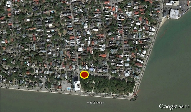
The dig site at the southeast corner of King and South Battery Streets in Charleston.
This morning the Walled City Task Force began a brief exploratory dig at the southeast corner of King and South Battery Streets, and we found some interesting materials. Did we find physical evidence to confirm the existence of the 1769 sea wall built of Bermuda stone and brick? Well, maybe. It’s a long story, and it’s going to take us a while to sort out the evidence and draw conclusions.

Part of the exposed brickwork at the southeast corner of King and South Battery Streets.
If you recall the earlier posting about this topic, we’re seeking to identify the line of bricks and stones that is visible along much of the northern edge of White Point Garden (see the photo below). This line doesn’t seem to be related to either the boundary of the park or the curb of South Battery Street, and so we suspect it is a vestige of a wall constructed in the summer of 1769 as a sea wall to protect the extensive and expensive fortifications that once stood at White Point. There is no documentary evidence to suggest that this wall was ever dismantled, and thus it would have stood as a visible, useful barrier for the neighborhood until a new wall was built around the western extension of White Point Garden ca. 1850.
Most of the early records of the City of Charleston were lost or destroyed during the chaos of the spring of 1865, however, so there is a big blind spot in our historical understanding of this site. We know from newspaper advertisements that there was some sort of repair or refashioning of this 1769 sea wall during the early years of the nineteenth century, but the extent of that work is unclear. In October of 1811, for example, the city advertised that it needed large “building stone” for construction of the East Battery sea wall (still standing today), and also “building stone of a smaller size from fifty to two hundred weight for South-Bay-street.” In October 1812, and again as late as April 1831, the city advertised its desire to contract with someone to repair “the stone wall on South Bay.” Based on what we found today, it appears that much (but perhaps not all) of the 1769 brick sea wall was rebuilt with granite stones in the early 1800s.

The first hole revealed a bonanza of rubble fill material, including large fragments of Bermuda stone.
Using a small backhoe and shovels, we dug (and later re-filled) three holes today. The first hole was on the north side (the land side) of the wall in question, approximately 100 feet east of King Street. Just a few inches below the surface, we encountered a bonanza of ballast stone, brick bats, and large chunks of Bermuda stone. The wall appears to be constructed solely of stones, and back-filled with dense rubble containing almost no artifacts. That description doesn’t match what we’re looking for, but the presence of the Bermuda stone fragments was a pleasant surprise. Charleston’s senior archaeologist, Martha Zierden of the Charleston Museum, says its very unusual to find such a concentration of Bermuda stone, even fragments of it, in Charleston. If this section of the 1769 wall was rebuilt with quarried stone ca. 1811, it would make sense that workers would excavate the surviving Bermuda stone and brick and recycle it as fill material.

The second hole, on the south side of the wall, showing nineteenth-century stone repairs and a late 20th century utility obstruction.
The second hole was dug on the south side (the water side) of the wall, approximately fifteen feet west of the first hole. Here we found the relatively clean face of a granite stone wall with a slight batter or slope from top to bottom. The soil in front of the wall was completely sterile and new, because sometime in the late twentieth century the power utility company built an extensive concrete chase that runs nearly the width of the park, parallel to the wall we’re investigating. After digging down approximately three feet, that utility line prevented us from exploring this side of the wall any further. As you can see in my photograph, it appears that this section of the 1769 sea wall was also rebuilt with stone in 1811.
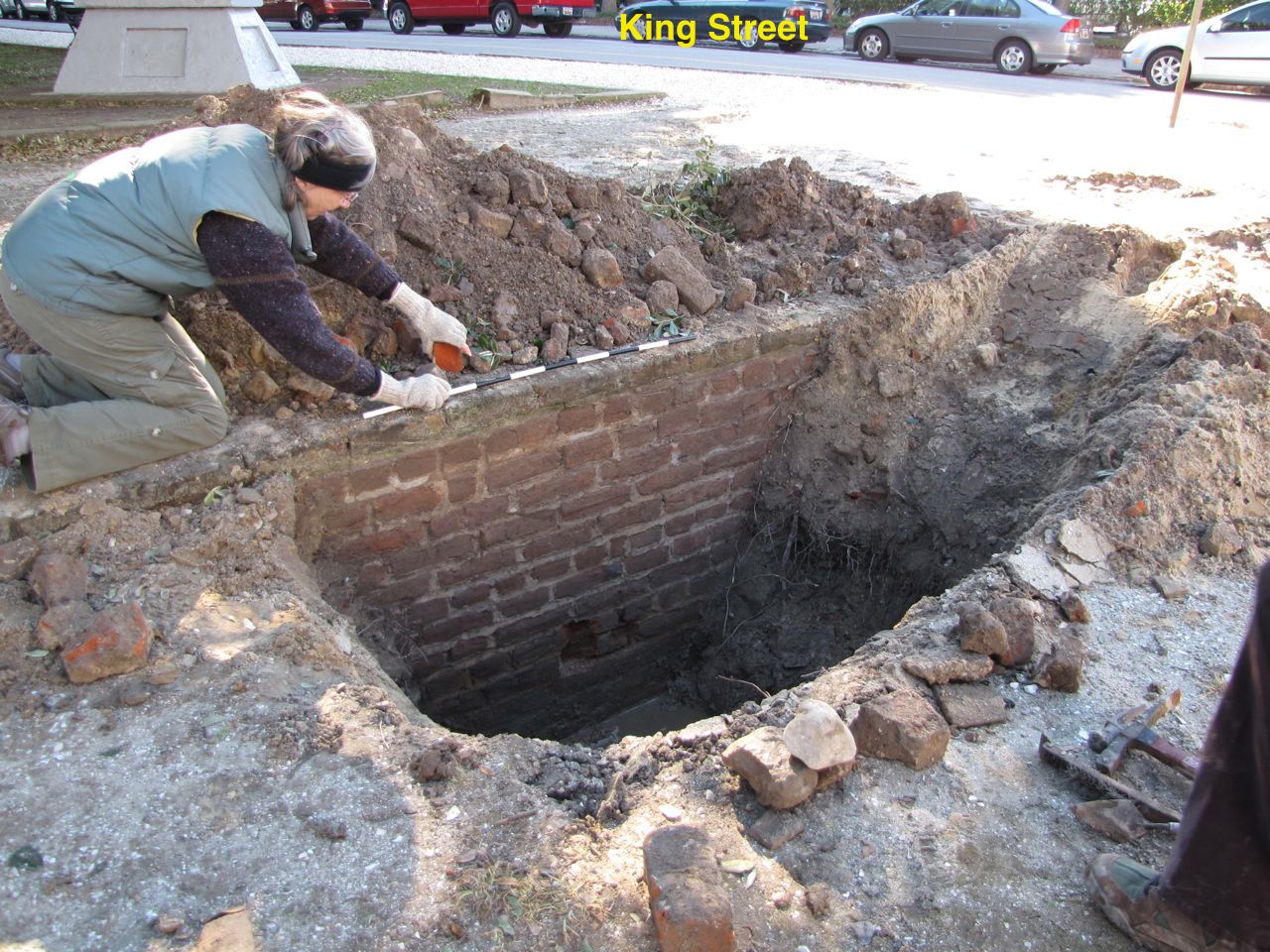
Martha Zierden places a photographic scale on the brick wall exposed in our third hole of the day.
The third and final hole of the day was located just a few feet east of the corner of King and South Battery, next to the clearly exposed line of brick. After just a few seconds of breaking the surface on the north side (land side) of the wall, we began seeing fragments of ceramics and glass. Martha Zierden dated them to the first half of the nineteenth-century. We were able to remove enough fill to expose fifteen courses of brick before water began to seep into the hole (remember the Ashley River is just a stone’s throw away). Although we were pleased to finally see some intact, old brickwork, the appearance of the brick was not quite what we were expecting. We found many fragments of colonial-era brick in the fill behind the wall, but as you can see in the photo below, the bond or pattern of the layout of the brick is more reminiscent of post-colonial-era work.

The brickwork of uncertain vintage, exposed in the day’s third hole.
Could it be that this section of the 1769 brick sea wall was also rebuilt ca. 1811, but with brick rather than stone? The determining factor in this question might be the presence or absence of Bermuda stone at the base of the brick work. Since the bottom course of bricks was actually below the water level, we couldn’t see what was there. A tactile investigation (that is, reaching into the mud) found only coarse silt and vague fragments, which might actually represent the remnants of degraded Bermuda stone (which is soft when under water and hardens only when exposed to dry air). In short, we’re not sure of the date of this construction.

Looking west toward the intersection of King and South Battery Streets.
All in all, it wasn’t a bad day of archaeology, despite the high temperature of only 48. We’ll return to the scene tomorrow and try to find further evidence to help us understand the construction history of this mysterious wall. Thursday should be a warmer day, so please drop by and have a look if you’re in the neighborhood. Remember, also, that there will be a public program in late March including recap the history of the 1768-1769 sea wall and a summary of the findings from this dig.
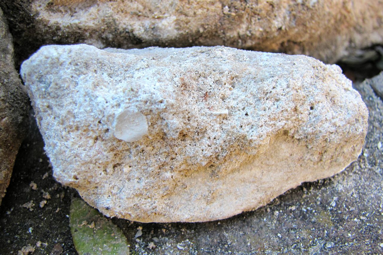
A small fragment of Bermuda stone excavated today.
Oh–and of course I have to include a photo of a Bermuda stone fragment recovered from this morning first dig. This material would have been sawed into a rectangular block originally, but as you can see now it’s quite degraded.


 Subscribe via email