South Adger’s Wharf


Another day’s work yields a better understanding of our colonial redan. As on Monday, the crew worked slowly and carefully through the materials already exposed and recorded their findings along the way. The results may be less dramatic than those seen in the past few days, but we made some interesting and subtle observations along the way.

blair_unit_1.jpg First, Martha Zierden and Blair Stec have been working for days on a small controlled unit, from the twenty-first century street surface to the bottom of Trench 1. It’s quiet work that hasn’t garnered much attention, but late in the afternoon Blair reported a discernible stain forming a line in the soil just east of two wooden posts. These features appear to be parallel to the line of the redan, approximately sixteen feet northeast of the northern flank of the wall. Hmm, might this be evidence of the moat that was cut on the outside of the redan (and along the entire length of East Bay Street) in 1745? That moat, which was filled at the end of 1764, was ordered to be twelve feet wide, so we might have found a trace of its outer edge.

poplin_explores_footing.jpg 
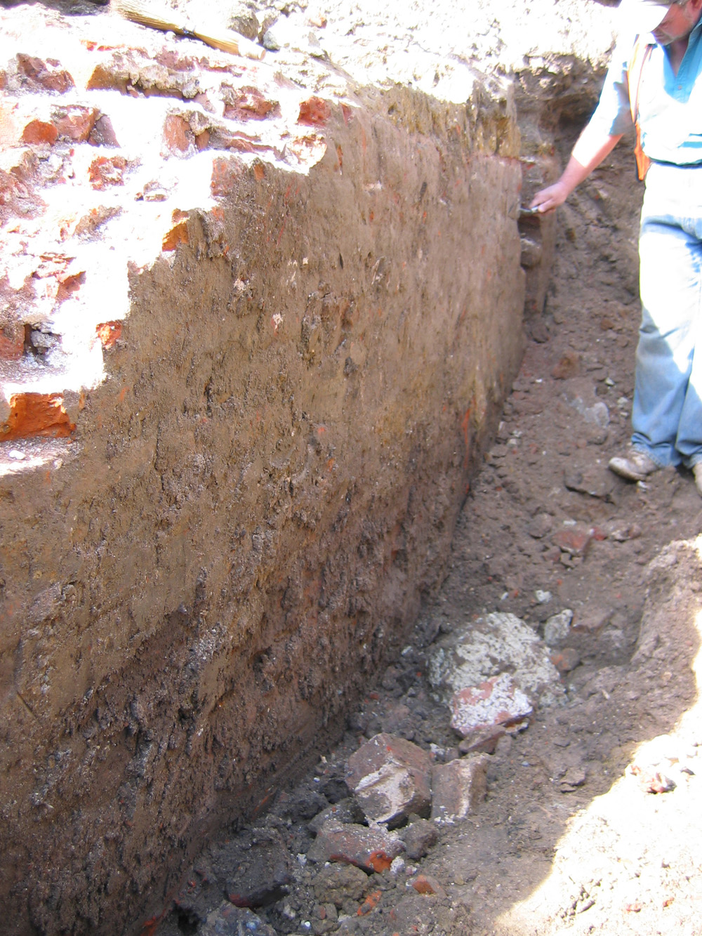
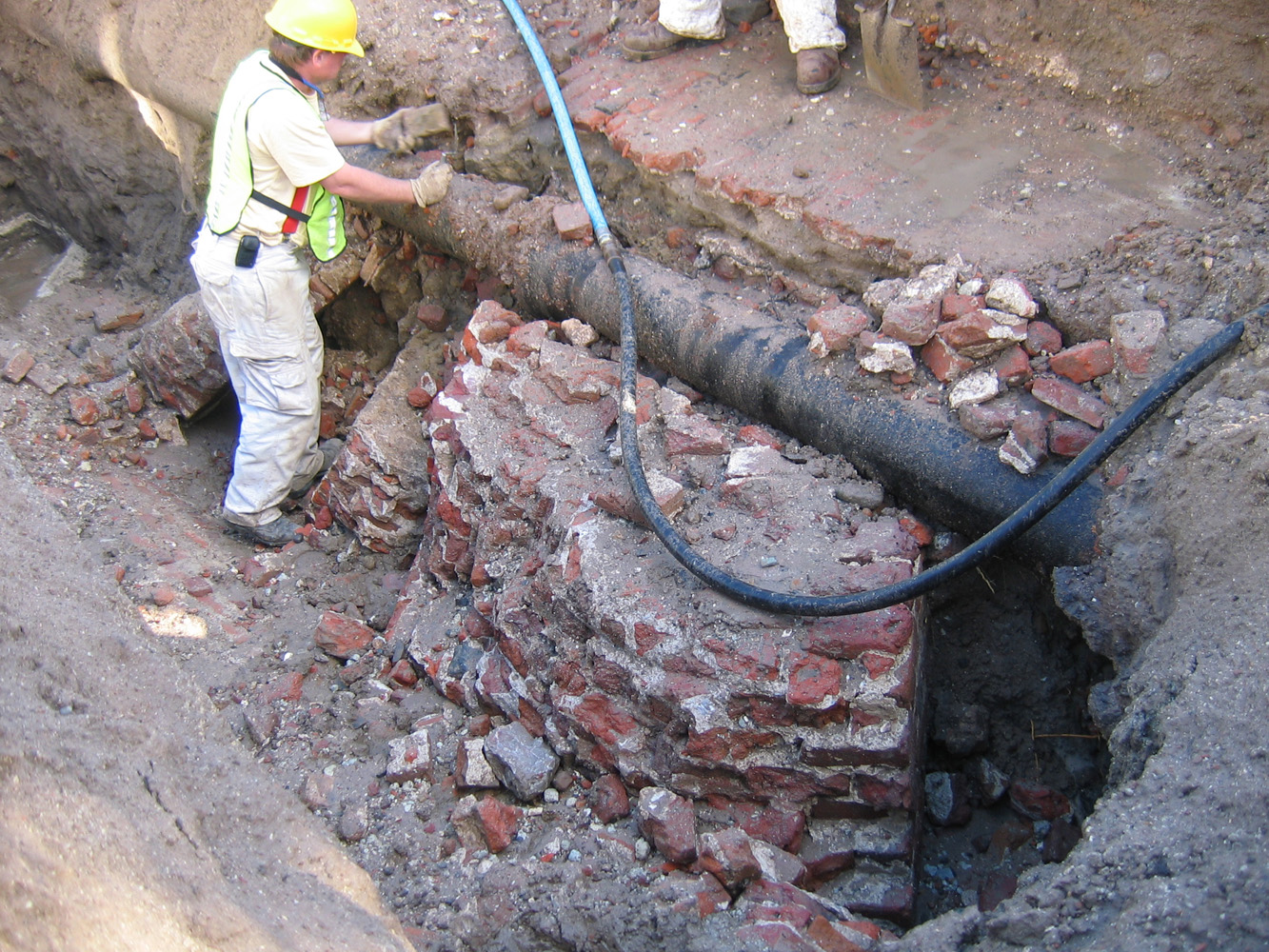
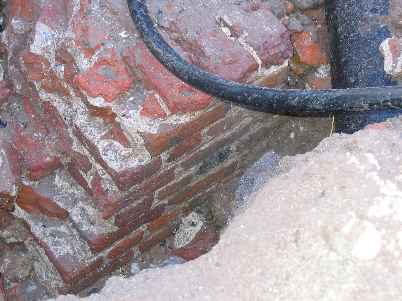
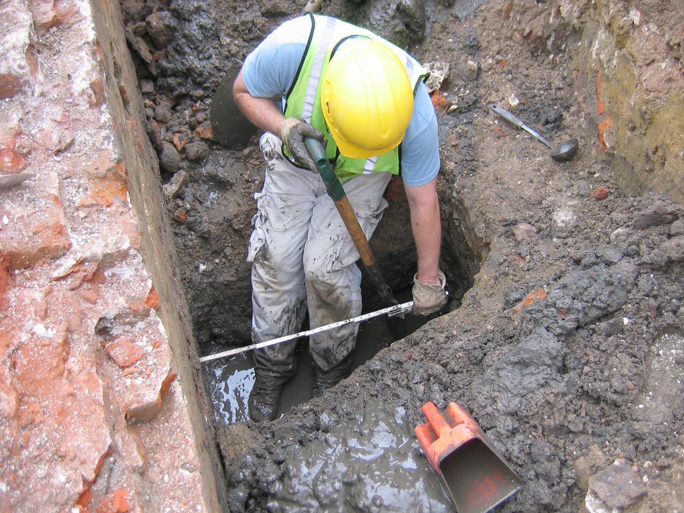
Meanwhile, back at the brick redan wall, Eric Poplin spent some time exploring the footings of the outer face of the exposed wall. Standing in front of the section that is three and a half feet wide, Eric discovered that the wall expands to five feet wide at a depth of approximately six feet below the present top of the wall. As you can see in the photo above, we have finally reached the water table at that depth. Reaching into the muddy water as far as my arm would reach, I could feel the five-feet-wide wall continuing straight downward to an unknown depth. Perhaps we’ll have time to explore the wall’s foundation next week. Rest assured that the final archaeological report will include precise measurements of these features relative to the current street grade.

lefebre_sweeps_redan.jpgredan_surface_cleaned.jpg 
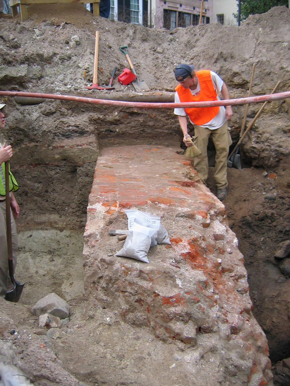
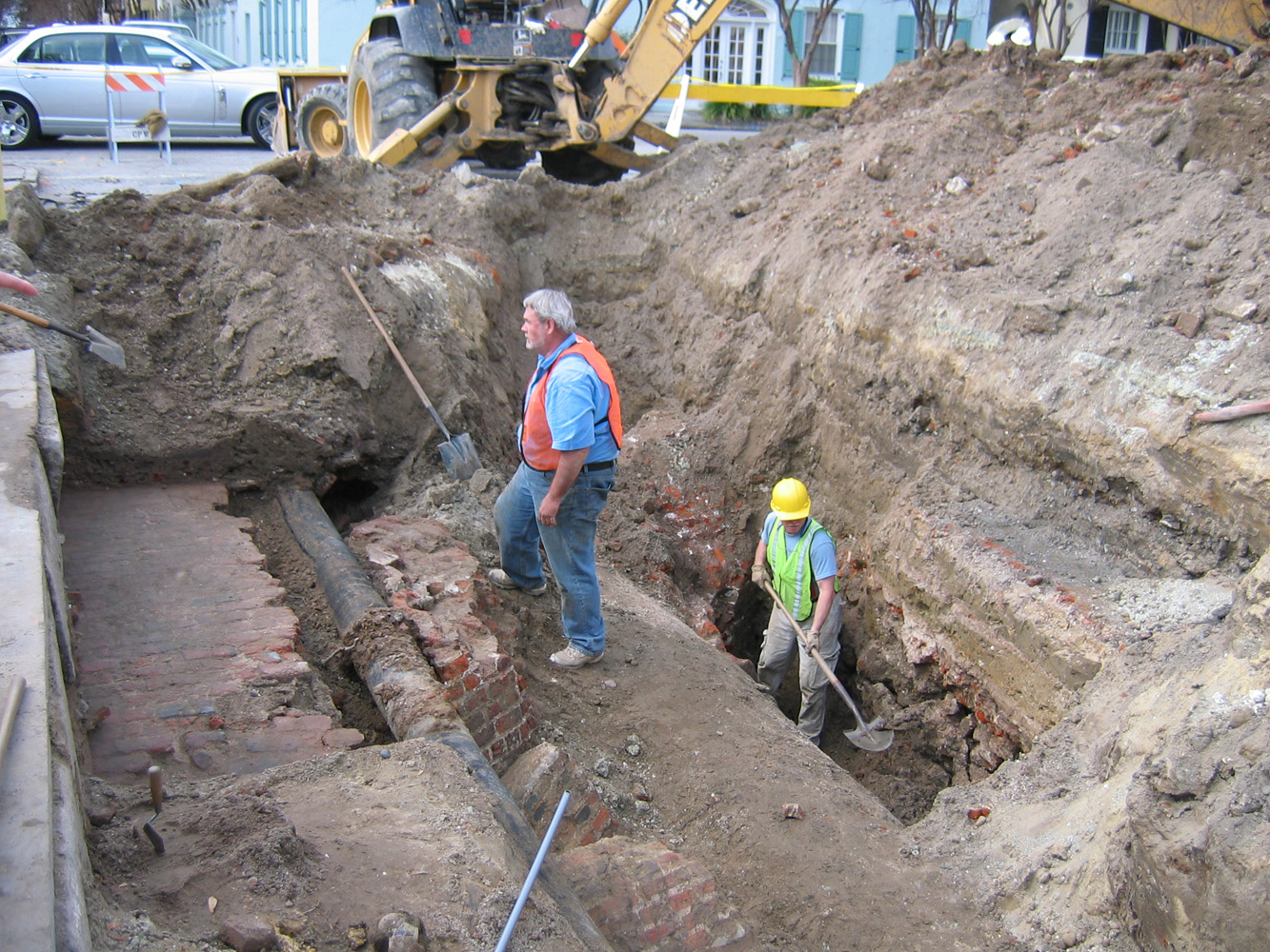
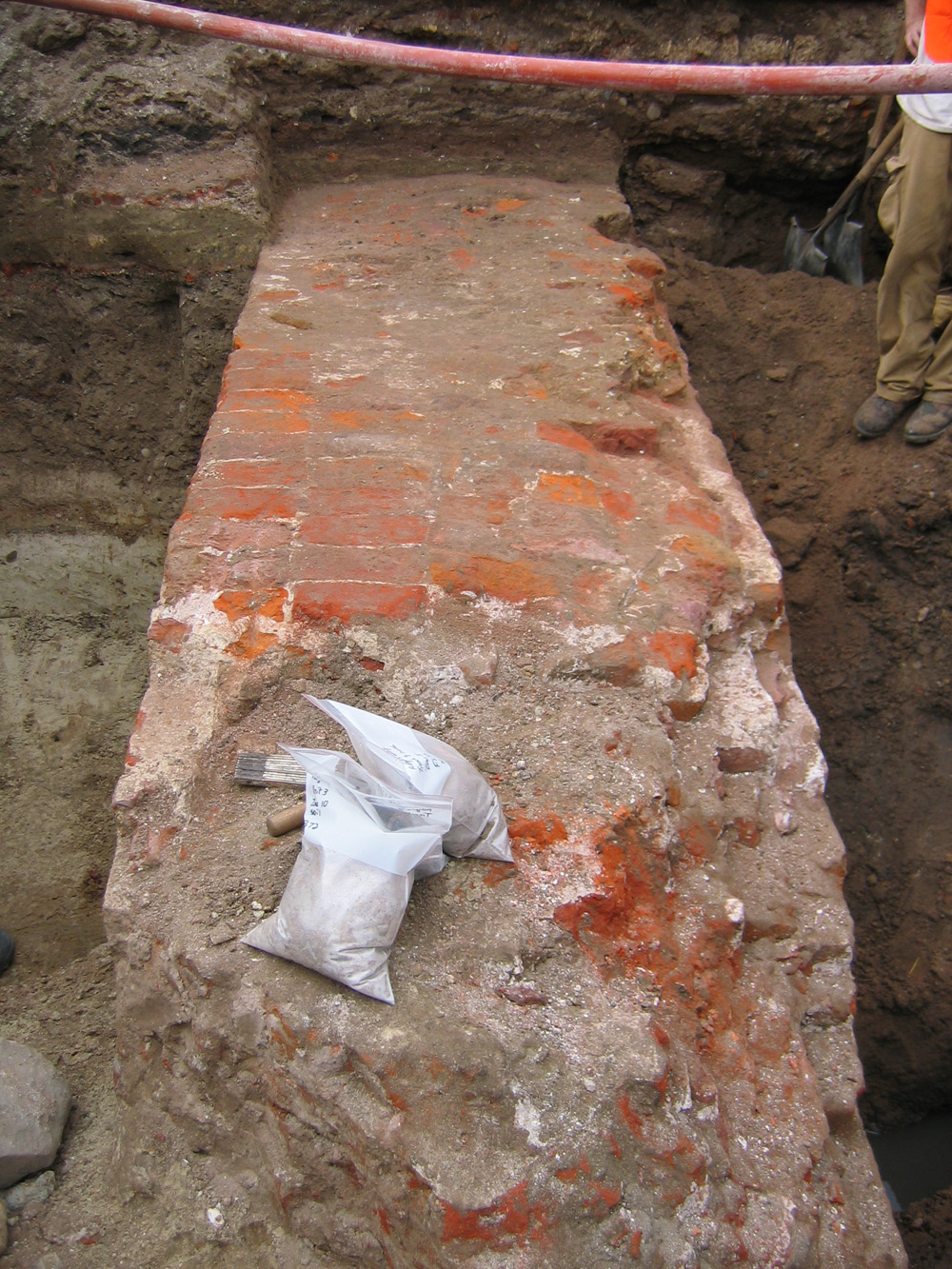
Ron Anthony and Jimmy Lefebre spent much of the day carefully removing and screening the soil from the top of the exposed redan wall. Their work revealed a fairly uniform surface that doesn’t really seem to reflect the known demolition of the brick mass above it. The wall in the photos here is three and a half feet wide at the top, but the missing brick mass that once stood above it (actually scattered in front of it now) may have been about half that width. It’s interesting to note that the top of the demolished redan was until today covered with a layer of clay and sand, apparently placed there to create a level surface for the brick floor of the Lower Market that was extended over it in 1786.

agha_inside_redan.jpg Andrew Agha has spent the past two days excavating a controlled unit behind the exposed section of the redan wall. In contrast to the area outside of the wall (on the Cooper River side), which is full of rubble and all sorts of debris, the area inside the wall contains a large amount of relatively clean sand, suggesting a very different sort of history. I look forward to talking further with Andrew to learn more about his thoughts on this topic.

ceramic_jug.jpgglass_jug.jpg 
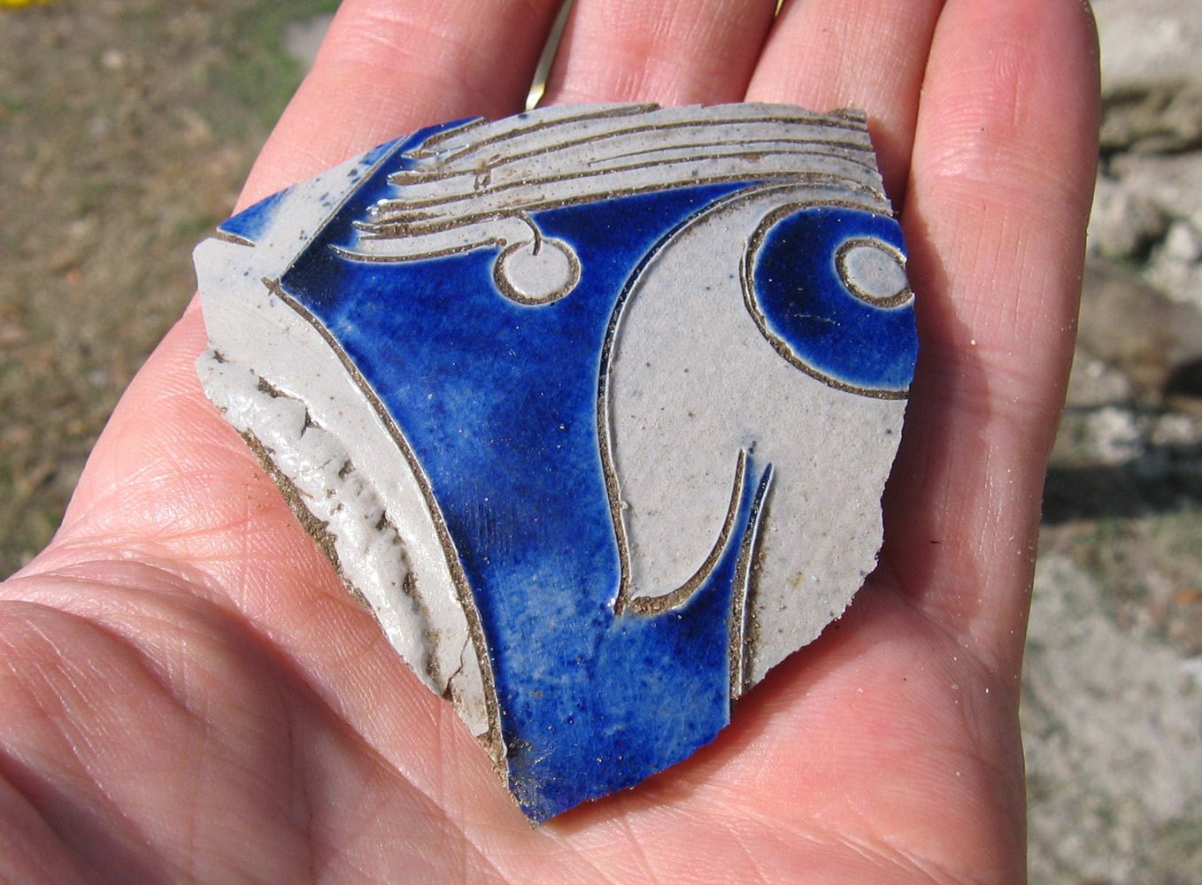
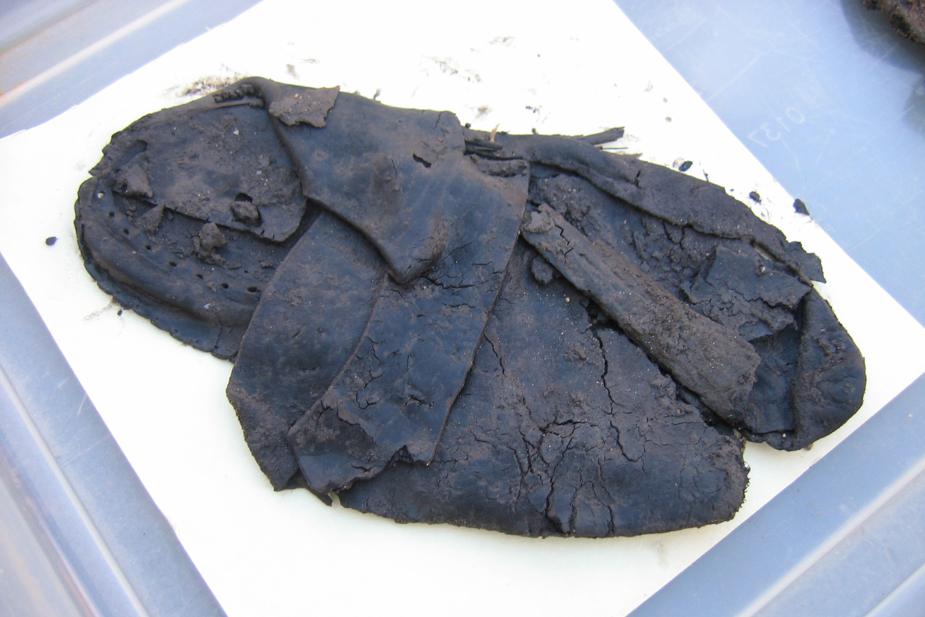
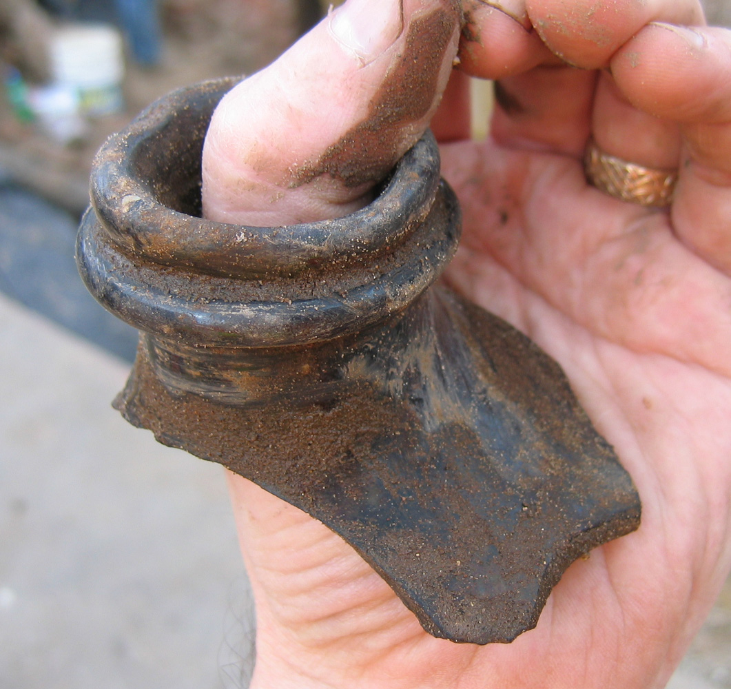
Last but not least, volunteers continue to find fragments of the past in the dirt they’re screening. We’ve found the shattered fragments of hundreds of old bottles, but today I was intrigued by the mouths of a couple of jugs—one ceramic and one glass. I think the size and proportions of these objects are impressive, and I hope you agree!

redan_35_feet_wide_3.jpgThe excavation of the soil around the north flank of the brick redan wall continued to be the most exciting development at South Adger’s Wharf today. redan_35_feet_wide_2.jpgContinuing the work started yesterday, archaeologists Ron Anthony and Andrew Agha chased the line of the wall towards the northwest (towards East Bay Street). After several hours of careful shovel work, they succeeded in uncovering a few more feet of the wall, but the presence of an active natural gas line prohibits any further movement in that northwestward direction. Despite this obstruction, however, they uncovered sufficient amount of the redan wall to form a hypothesis about the curious structural characteristics noted yesterday afternoon.

The first part of the redan wall uncovered earlier this week is five feet wide with an outward slope on the outer face. Yesterday we discovered that the northwestward continuation of the wall is only three and a half feet wide (not four feet as reported earlier) and is not sloped on the outer face. After uncovering another meter of the wall, it became clear that this part of the wall, the western end of the redan’s north flank, is consistently flat on the outside and three and half feet wide. redan_outer_face_west_end.jpgSince these features appears to be more than just structural anomalies, the archaeologists and historians put their heads together to come up with a theory. We’re currently thinking that the eastern end of the redan, towards its apex, is thicker and flared outward in order to provide additional support for the brick set into the original tidal mudflat, and to help protect the redan from the ravages of storms. We’ll work on sketching a visual representation, but in the meantime it might help to imagine that the apex of the redan looks like a cross between an arrowhead and a cowcatcher on the front of an old steam locomotive.

redan_opening.jpg

In addition to that structural curiosity, Ron Anthony’s trowel discovered a small void in part of the outer face of the redan wall. It appears to be a small square, less than a foot on a side, that is only about eight inches deep (don’t worry, we’ll take accurate measurements soon!). What was the purpose of this cavity? Was it a notch left for a beam? Was it a step used by brick masons climbing the outer face of the wall during its construction three hundred years ago? Hmm. Any ideas?

ceramic_1.jpg

ceramic_2.jpgVolunteers have been screening dirt for artifacts every day and finding beautiful old pieces of the past. We don’t have time or space for a full gallery of the objects, but today I’m offering images of two of my favorite finds from today’s screening. I’m afraid I can’t identify their type or age—I’ll leave that up to the archaeologists! These ceramic objects, imported by ship from Europe, display some of the most interesting colors and patterns. It’s so rewarding to pull these little gems from the obscurity of the dark soil!

Redan_continues_northwest_1.jpgOne of the top priorities for today’s activity at the South Adger’s Wharf dig was chasing the northwestward continuation of the brick redan to the point where it connects with the brick curtain wall along East Bay Street. Under the watchful eye of archaeologists Eric Poplin and Ron Anthony, the backhoe scooped out more fill until the top of the redan was seen, and then the shovel work began. After an hour or so of hand digging, the archaeologists uncovered the continuation of the five-foot wide brick redan. As expected, it lies in a northwest diagonal line, and is located on the northwest side of a four-foot wide brick drain (probably dating from the 1850s) that slices directly through the remnants of the redan. redan_continues_northwest_2.jpgLater in the afternoon, after further fill material was removed, the crew discovered that the continuation of the redan on the northwest side of the brick drain is not quite the same as the portion uncovered earlier. The five-feet-wide wall makes a sudden transition to a four-feet width, and the slight outward slope of the wall disappears. A brief downward probe revealed the presence of a slightly wider footing, and then the resumption of the outward slope. Hmm, very curious! Further digging and three-dimensional sketching will be required to sort out these puzzling characteristics.

Two additional factors complicate the picture in the west end of Trench 2. First, there is a large amount of brick rubble just east (i.e., outside) of the redan. Poplin and Anthony don’t seem phased by this rubble—they’re confident that it represents the demolition of the redan in 1785. Second, there is a significant amount of debris representing the extension of the “Lower Market” over the redan fragments in 1786. Archaeologist Martha Zierden is very excited about exploring this material, and soon will be working carefully through the surviving brick floor of the old market and sifting its contents.

mayor_riley_2.jpg mayor_riley_1.jpgAbout mid-morning Charleston’s mayor, Joseph P. Riley Jr., paid an executive visit to the site. Katherine Saunders, co-chair of the Walled City Task Force, provided a brief tour, and archaeologist Martha Zierden explained some of the interesting features uncovered so far. Mayor Riley’s keen interest in Charleston history led to the bulk of the funding for this excavation and we owe him a great debt of gratitude. We certainly hope that the enthusiastic public support for this work and the substantial amount of scientific data recovered at South Adger’s Wharf will be sufficient dividend for the city’s investment.

screening_dirt_at_saw.jpg Thanks again to our volunteers, young and old(er)! Without their help we would miss finding so many important bits and pieces of the past that come up in the buckets of dirt.

Another amazing day at the South Adger’s Wharf dig site! While the bulk of yesterday’s activities focused on studying and recording the soil strata uncovered during the first two days, the highlight of today’s work was the revelation of the main body of the brick redan that dates back to 1696. redan_fragments_in_foreground.jpgOn Friday we uncovered a substantial brick fragment, about 1.5 feet thick, that we knew had to be part of the redan, but some aspects of its position and orientation raised questions about its precise identity. After Trench 2 was continued several feet westward (towards East Bay Street) today, however, archaeologists Eric Poplin and Ron Anthony discovered another large brick fragment behind the first, and then another, larger brick mass behind the second. After washing away some of the mud, voila! We found the main body of the redan!

redan_north_flank.jpg We soon realized that our suspicions about the orientation of the brick fragments encountered earlier were well founded. Our best theories about the location of the redan were based on a highly-detailed 1785 plat drawn by respected surveyor Joseph Purcell. On Friday of last week we thought we might have found part of the south flank of the triangular redan, when in fact we seem to have found part of the north flank of the redan wall! Hmm, Mr. Purcell’s plat apparently isn’t as accurate as we had hoped.

The two thinner brick fragments, visible in the photos above, probably represent part of the uppermost part of the wall—the parapet with embrasures or openings through which the cannon once projected. It seems that the upper parts of these walls may have been simply knocked over in 1785 and allowed to tumble eastward into the mud.

redan_inner_face.jpg Once the mud was cleared away from the redan, we were able to get a good look at it for the first time. Even though the uppermost, above-ground mass of the redan was demolished about 1785, the remnants, located only about three feet below the modern street level, are five feet wide and composed of solid brick. The inner or westward face of the redan, seen in the photo to the left, presents a flat and uniform surface, and is laid in English bond pattern. redan_outer_face.jpg In contrast, however, the outer or eastern face, seen in the photo to the right, is slightly raked or sloped (approximately one inch to the linear foot). These characteristics are familiar to members of the Mayor’s Walled City Task Force because they match exactly the surviving brick work of two contemporary structures: Granville’s Bastion (under the Missroon House, the headquarters of the Historic Charleston Foundation) and the Half-Moon Battery (under the Old Exchange Building).

On top of the remnants of the redan—and perhaps at a consistent level throughout the eastern end of the dig site—is a single layer of thin paving bricks (see the topmost photos above). Martha Zierden suspects that these brick pavers represent the floor of the Lower Market, which we know was extended westward in 1786 over the ground formerly occupied by the redan. Martha will continue exploring this possibility in the next few days by continuing to take precise measurements and elevations of the site.

shoe_leather.jpg A big thank you to the volunteers who are diligently screening dirt for artifacts. Without their hard work we wouldn’t be able to find such interesting articles as ancient leather!

In the past few days the archaeological excavation at South Adger’s Wharf has attracted the attention of many Charlestonians, tourists, and journalists. If you would like to meet some members of the Mayor’s Walled City Task Force and hear the archaeologists talk about their work at the dig, you’re invited to join us for a public program at the Charleston County Public Library on Wednesday, January 30th 2008, at 7:00 p.m.

On that evening, Dr. Nic Butler, Special Collections manager at the library, will host a program titled “New Archaeology in Charleston: The South Adger’s Wharf Dig.” Besides hearing first-person reports from the participants, you’ll learn about the history of the site, see more photographs from the excavation, and even see some of the artifacts uncovered at the dig.

« Previous PageNext Page »