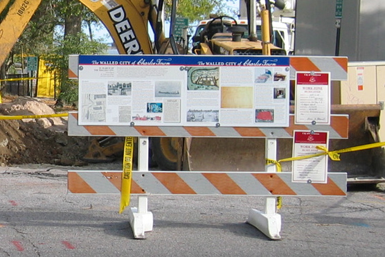
 If you’ve had an opportunity to visit the archaeological dig at South Adger’s Wharf, we hope you took the time to peruse a pair of educational panels (each two feet by three feet) mounted on a construction barrier along East Bay Street. Katherine Saunders of the Historic Charleston Foundation had these elegant panels fabricated in October 2007, in preparation for the educational component of this archaeological project. Many people have commented on the quality of the images and text on the posters themselves, so we’re pleased to be able to make them available to students of Charleston’s colonial history and supporters of the Mayor’s Walled City Task Force. If you’d like to take a closer look at the posters, we invite you to view a new page on this website called simply Educational Posters.
HCF
13 January 2008
Educational Posters
Posted by Nic Butler, Ph.D. under archaeology, Charleston, fortifications, HCF, history, South Adger's WharfLeave a Comment
8 January 2008
Archaeology at SAW, Day 4
Posted by Nic Butler, Ph.D. under archaeology, Charleston, fortifications, HCF, history, South Adger's Wharf[4] Comments
Another amazing day at the South Adger’s Wharf dig site! While the bulk of yesterday’s activities focused on studying and recording the soil strata uncovered during the first two days, the highlight of today’s work was the revelation of the main body of the brick redan that dates back to 1696.  On Friday we uncovered a substantial brick fragment, about 1.5 feet thick, that we knew had to be part of the redan, but some aspects of its position and orientation raised questions about its precise identity. After Trench 2 was continued several feet westward (towards East Bay Street) today, however, archaeologists Eric Poplin and Ron Anthony discovered another large brick fragment behind the first, and then another, larger brick mass behind the second. After washing away some of the mud, voila! We found the main body of the redan!
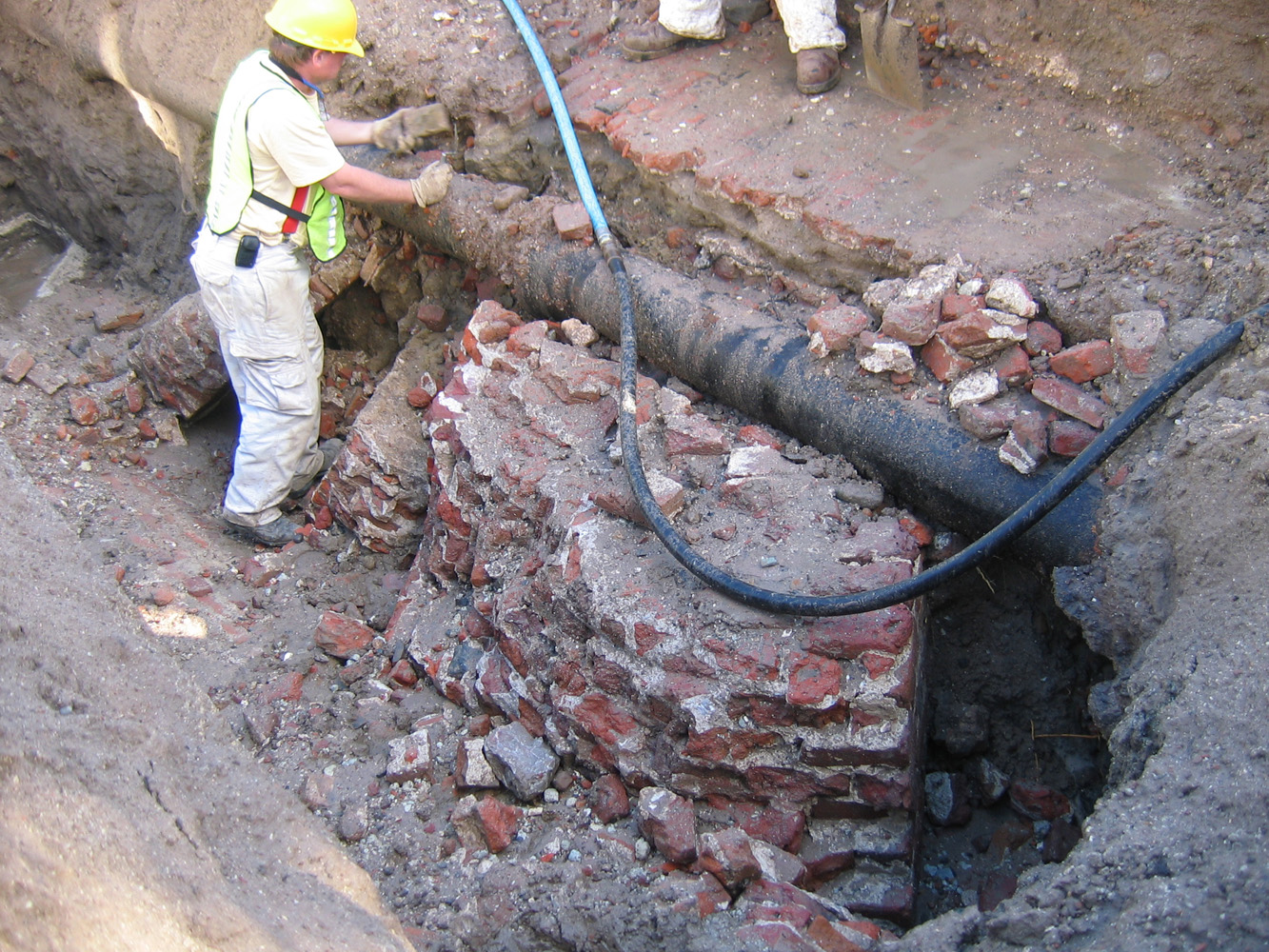 We soon realized that our suspicions about the orientation of the brick fragments encountered earlier were well founded. Our best theories about the location of the redan were based on a highly-detailed 1785 plat drawn by respected surveyor Joseph Purcell. On Friday of last week we thought we might have found part of the south flank of the triangular redan, when in fact we seem to have found part of the north flank of the redan wall! Hmm, Mr. Purcell’s plat apparently isn’t as accurate as we had hoped.
The two thinner brick fragments, visible in the photos above, probably represent part of the uppermost part of the wall—the parapet with embrasures or openings through which the cannon once projected. It seems that the upper parts of these walls may have been simply knocked over in 1785 and allowed to tumble eastward into the mud.
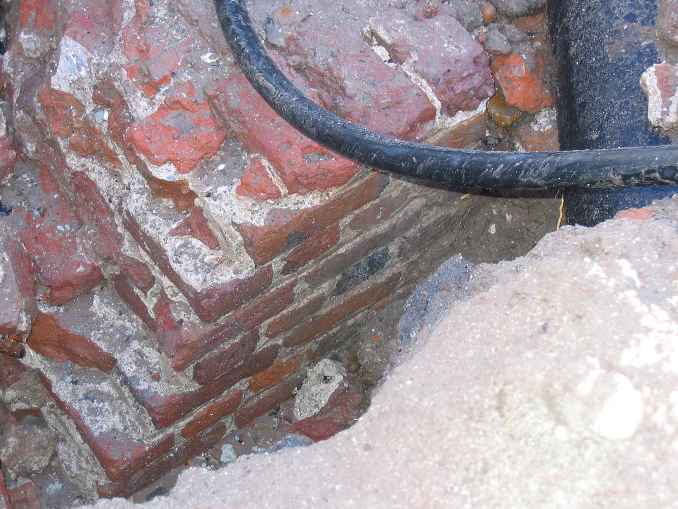 Once the mud was cleared away from the redan, we were able to get a good look at it for the first time. Even though the uppermost, above-ground mass of the redan was demolished about 1785, the remnants, located only about three feet below the modern street level, are five feet wide and composed of solid brick. The inner or westward face of the redan, seen in the photo to the left, presents a flat and uniform surface, and is laid in English bond pattern.
  In contrast, however, the outer or eastern face, seen in the photo to the right, is slightly raked or sloped (approximately one inch to the linear foot). These characteristics are familiar to members of the Mayor’s Walled City Task Force because they match exactly the surviving brick work of two contemporary structures: Granville’s Bastion (under the Missroon House, the headquarters of the Historic Charleston Foundation) and the Half-Moon Battery (under the Old Exchange Building).
On top of the remnants of the redan—and perhaps at a consistent level throughout the eastern end of the dig site—is a single layer of thin paving bricks (see the topmost photos above). Martha Zierden suspects that these brick pavers represent the floor of the Lower Market, which we know was extended westward in 1786 over the ground formerly occupied by the redan. Martha will continue exploring this possibility in the next few days by continuing to take precise measurements and elevations of the site.
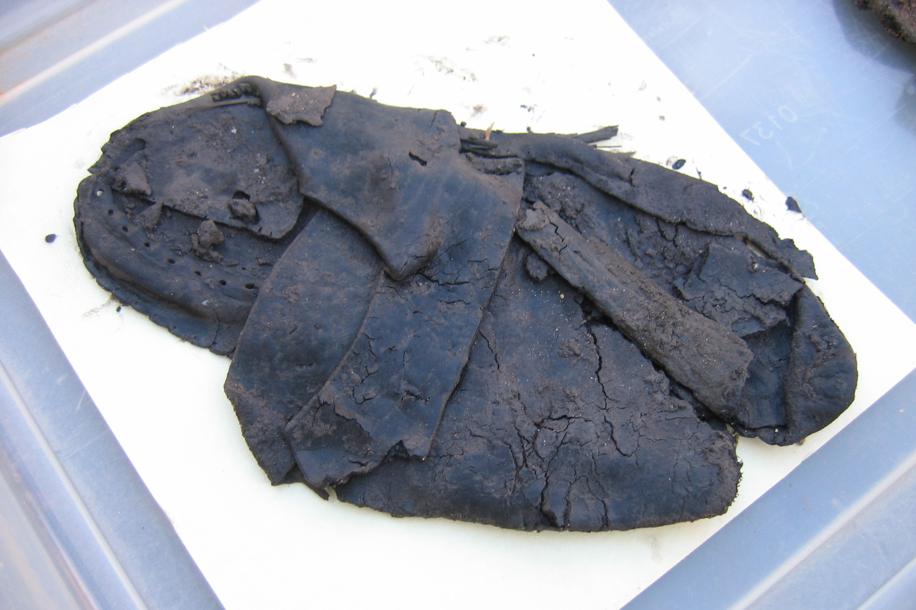 A big thank you to the volunteers who are diligently screening dirt for artifacts. Without their hard work we wouldn’t be able to find such interesting articles as ancient leather!
15 October 2007
Come “Walk the Walls” on Thursday
Posted by Nic Butler, Ph.D. under Charleston, fortifications, HCF, programsLeave a Comment
This Thursday, October 18th, you’re invited to join members of the Walled City Task Force and the Young Advocates of the Historic Charleston Foundation for a fun and educational evening. It’s time for the autumn “Walk the Walls” event, and the weather should be just right for a bit of history, food, drink, music, and conversation under the stars in Charleston. Come join us at 40 East Bay Street at 6:00 p.m. for a self-paced stroll along the path of Charleston’s early defensive walls. At significant points along the way, you’ll meet interpreters who’ll help breath life into the history of that site. We’ll finish the evening off with dinner and music harbor-side at the Missroon House, where you’ll have a chance to chat with other “walled city” enthusiasts. Besides having a great time, you’ll be contributing to the Task Force’s preservation efforts.
I hope to see you there!
 Subscribe via email