fortifications


1739 view of the Half-Moon Battery by Bishop Roberts

1739 view of the Half-Moon Battery by Bishop Roberts

The brick Half-Moon Battery below Charleston’s Old Exchange Building is the most visible and intact vestige of the city’s colonial fortifications. Constructed more than 300 years ago, it hosted some of the most colorful and gruesome episodes in Charleston’s history, and still holds a few mysteries to be solved. Want to learn more about this important remnant of Charleston’s colonial past? Please join us for an illustrated program entitled:

“The Half-Moon Battery: A Brief History of a Charleston Landmark”

  • Wednesday, January 23d at 6:30 p.m., Charleston County Public Library, 68 Calhoun Street, 2nd Floor Classroom.
Granvill's Bastion in 1739

Granville’s Bastion as it appeared in 1739

Commissioned in 1696 and dismantled in 1785, Granville’s Bastion was Charleston’s first brick “fortress” and the principal defensive work along the Cooper River waterfront. Here twelve cannon guarded the southeast corner of the town, overlooking a small beach where royal governors and visiting dignitaries were received with pomp and ceremony. Only its foundations remain today, under the present Missroon House, but the surviving materials provide sufficient clues to facilitate a conjectural reconstruction. Please join historian Nic Butler on November 28th for an illustrated review of the history of Granville’s Bastion, and learn how new technology can be used to render a 3D model of this once-formidable structure.

Granville’s Bastion: Charleston’s First Brick Fortress

Place: Charleston County Public Library, 2nd Floor Classroom

Time: Wednesday, November 28th 2012, at 6:30 p.m.

From the late 1690s to the mid-1780s, Charleston’s waterfront along the Cooper River was protected by a substantial brick “wharf wall” or “curtain line,” stretching nearly 2,600 feet in length. That wall formed the front line of the town’s defenses, and stood longer than any other part of our colonial-era fortifications. After being continuously repaired and partially rebuilt on several occasions during the early eighteenth century, the brick “wharf wall” was razed to street level in the mid-1780s after the conclusion of the American Revolutionary War. Remnants of the foundation of this wall still exist along the length of East Bay Street, from the Missroon House to the U.S. Custom House, but little information has yet been gathered about its width, height, and precise location.

As part of its mission, the Mayor’s Walled City Task Force is endeavoring to correct these factual shortcomings. Recent archaeology and documentary research is now giving us a better understanding of the old “wharf wall.” The public is invited to learn more about this topic by attending a free lecture, hosted by Dr. Nic Butler, entitled

“Charleston’s ‘Wharf Wall’: Front Line of our Colonial Defenses.”

Time: Wednesday, October 24th 2012, at 6:30 p.m.

Place: Charleston County Public Library, 2nd Floor Classroom

The Mayor’s Walled City Task Force is very pleased to announce that the long-awaited interpretive signage has been installed at the intersection of East Bay Street and South Adger’s Wharf, where archaeological digs in January 2008 and June 2009 uncovered the remnants of the colonial-era redan (or salient angle) that stood at the east end of Tradd Street. The signage consists of two handsome, illustrated text panels, created by the History Workshop, which offer a brief overview of Charleston’s colonial fortifications and also explain the mission of the Mayor’s Walled City Task Force. More importantly, these panels summarize the recent archaeology at South Adger’s Wharf, and serve to mark the site of that important exploration of our city’s colonial fabric. Note also that between the signs stands a small fragment of the parapet (uppermost part of the wall) of the Tradd Street redan that was unearthed from this site during our excavations.  For more information about these panels, take a look at the the following images, or take a stroll down East Bay Street and see them yourself!

Looking northeast from the east end of Tradd Street

Looking southeast from the east end of Tradd Street

Click the image above to enlarge

Click the image above to enlarge

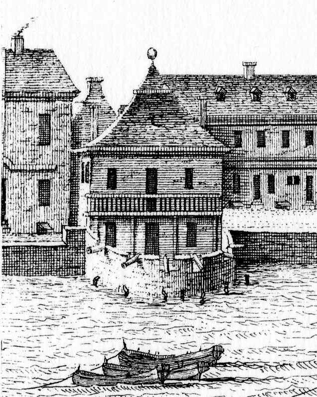
Missroon House (center)

On 21 December 2009, a City of Charleston’s stormwater drainage crew parked next to the Missroon House, No. 40 East Bay Street, to address a routine problem. Their equipment had detected a subterranean leak in the main drain running down the center of East Bay Street, near the point where East Bay Street becomes East Battery Street. After opening a small hole in the asphalt road surface, the work crew dug a few feet down and found the leak in the old nineteenth-century brick arched drain. In the process, they also uncovered a small portion of the south wall of Granville Bastion.


Walled City Task Force co-chair Katherine Saunders was right on the spot since the Missroon House, the home of the Historic Charleston Foundation, literally sits directly on top of the eastern portion of Granville Bastion. With her iPhone, she snapped a few photographs to document both the location and the materials. As you can see in the photos below, the nineteenth-century drain, constructed of grayish bricks on the right, intersects the bright reddish-orange bricks of the colonial bastion. The Task Force encountered a very similar phenomenon while digging at South Adger’s Wharf in January 2008. In both cases, the colonial brickwork was excised just enough to make room for the drain

Granville Bastion was the first and the largest of Charleston’s brick bastions, commissioned by an act of the legislature in late 1696. During the early years of the eighteenth century it was frequently called simply “the Fort” because of its size and its importance to the town’s waterfront defenses. It was here that each of the colonial governors was formally welcomed, and the birthdays of the king and queen of England were publicly toasted.

While this brief sighting on 21 December 2009 did not include any exploratory digging or archaeological investigation, it did provide valuable confirmation that substantial remnants of Granville Bastion survive under the roadbed of modern East Bay Street. A substantial portion of southeast corner of Granville Bastion is exposed under the foundation of the Missroon House, several yards east of the street, but that area is not easily accessible and is not open to the public. For the time being, the remnants of Charleston’s first brick “fort” lie safely hidden beneath the modern hardscape, invisible to the throngs of tourists walking along the High Battery along Charleston’s picturesque waterfront.

« Previous PageNext Page »