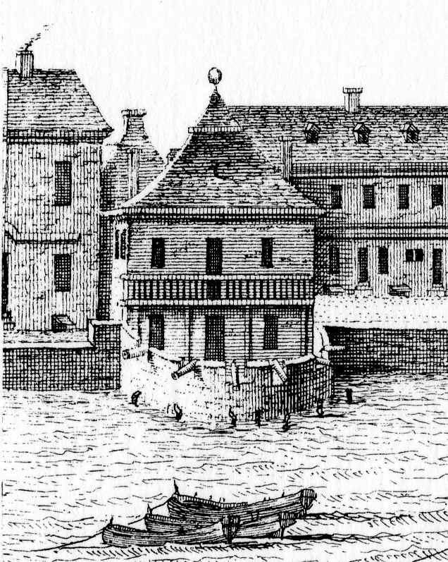
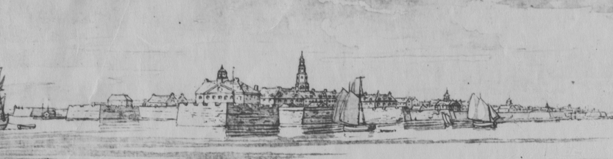
1739 view of the Half-Moon Battery by Bishop Roberts
Charleston’s Half Moon Battery, located under the Old Exchange Building, is the only remnant of our early colonial fortifications that is currently accessible by the public. Constructed more than three centuries ago, this brick battery served as the center point of the nascent town’s waterfront defenses until it was razed to street level in 1768 for the construction of what was then called the “New Exchange.” Its existence was subsequently forgotten for many generations, but since being rediscovered in 1965 it has been open for public viewing.
The surviving records of South Carolina’s colonial legislature contain very scanty evidence of the design and construction of the Half Moon Battery, and even less information about the “Watch House” that was erected along the western edge of the battery. After a “nice scrutiny” of the evidence (to quote a phrase from those records), however, I have concluded that the brick, Half Moon Battery was constructed in 1701–2, and the one-story “stone” Watch House was erected sometime between 1698 and 1703. Readers familiar with the Bishop Roberts’ 1739 “Exact Prospect of Charles-Town” will note that the latter structure appears in that publication as a two-story building called the “Council Chamber above & Guard House below.” The same aforementioned colonial legislative records also reveal that the early “Watch House” was enlarged into a two-story government structure in 1727, and acquired its new name by the spring of 1731.
What else do the surviving records of South Carolina’s early government reveal about the construction of the Half Moon Battery? Unfortunately, not very much. After pouring over the extant documentary evidence, and a limited amount of archaeological evidence from the 1960s, however, I’ve been working on a three-dimensional model of the battery that will hopefully give us a better idea of its construction and appearance. It’s all a work in progress, but I’ll be offering my latest thoughts and conclusions in the next “Walled City” program this Wednesday:
“The Half Moon Battery, 1701–1768: A Charleston Landmark”
Time: Wednesday, April 23d 2014 at 6:00 p.m.
Place: Second Floor Classroom, Charleston County Public Library, 68 Calhoun St., 29401.


 Subscribe via email