archaeology


The name “Fort Johnson” is familiar to nearly every resident of the Charleston area, especially those on James Island who live on or near the scenic Fort Johnson Road. Hundreds of people work and study every day at the NOAA’s Hollings Marine Laboratory and Center for Coastal Environmental Health and Biomolecular Research, the College of Charleston’s Grice Marine Laboratory, MUSC’s Marine Biomedecine and Environmental Sciences Center, and SCDNR’s Marine Resources Research Institute, all of which are located on the grounds of Fort Johnson. But how many people know anything about the history of the old fort itself, which was dismantled more than a century ago? Sadly, few remember that construction on Fort Johnson started at Windmill Point on James Island three hundred years ago—in the year 1708.

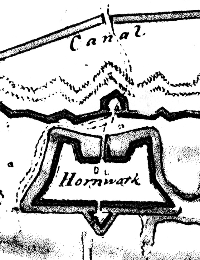
Fort Johnson was designed and built in 1708 by Huguenot refugees to protect the English colony of South Carolina from attack by Spanish and French forces. It suffered damage from numerous storms and was entirely rebuilt in 1759. In September 1775 the fort was captured by South Carolina patriots at the beginning American Revolution. In the 1790s Fort Johnson was again rebuilt and again destroyed by storms during the War of 1812. The site was fortified during the Civil War and occupied by Confederate forces until 1865. After the war, the remnants of the fort were allowed to decay as the site became used for other purposes, including a quarantine station for immigrants.

To mark the 300th anniversary of the construction of Fort Johnson, the Charleston Archive and the Mayor’s Walled City Task Force will be presenting a free program at the main branch of the Charleston County Public Library to raise public awareness of this site’s rich history. On Thursday, December 11th 2008, Dr. Nic Butler, manager of the Charleston Archive and historian for the Task Force, will provide an illustrated overview of the fort’s history, and archaeologist Carl Steen, of the Diachronic Research Foundation, will discuss his recent investigations at this important site. Please join us!

fort_johnson_flyerThursday, 11 December 2008
6:30 p.m.
Charleston County Public Library Auditorium
68 Calhoun Street

The St. Augustine Record reported yesterday that city archaeologist Carl Halbirt had unearthed another section of a wall constructed of coquina stone that once surrounded the city. Known as the Rosario Line, the wall was constructed around 1762, at the very end of Spanish control over Florida, and once stood between six and seven feet above ground. The Record states that discovery appears to support some historians’ assertion that St. Augustine was once the most heavily defended community in this nation. “Some communities like Charleston used its resources to develop a plantation economy,” Halbirt is quoted as saying, “[while] (Spanish) St. Augustine used all its resources to defend itself against the English.”

While I agree that this is an exciting archaeological discovery, my enthusiasm is tempered by two historical points.

First, the Rosario Line, described as a relatively narrow stone wall approximately six to seven feet high, would have been a very antiquated—even impractical—style of fortification line by the middle of the eighteenth century. Stone walls shatter when hit by cannon fire, necessitating costly and time-consuming repairs. By the 1760s, the era of the Rosario Line, European military engineers like John Muller were advocating the use of thicker walls made primarily of earth as a more practical alternative. With the exception of the brick “wharf wall” along Charleston’s eastern shoreline, and the tabby bastion walls constructed in the 1750s, this city’s walls were mostly of the earthwork variety.

Second, St. Augustine’s long history as a walled city is inextricably linked to the rise of similar fortifications in colonial Charleston. Between the founding of this English city in 1670 and the end of Spanish control of Florida in 1763, Charleston and St. Augustine engaged in a sort of colonial arms race that spurred the construction of urban fortifications in both towns on a scale not witnessed in most other North American communities. While Carl Halbirt asserts that colonial Charleston spent its fortunes on developing a plantation economy, he is not yet aware of my recent research proving that Charleston’s urban fortifications were colonial South Carolina’s greatest public works project and that this city’s landscape included defensive walls, bastions, moats, and drawbridges from the 1680s to the 1780s.

I believe there are two important lessons to be learned from the recent archaeological discovery in St. Augustine. First, the city of Charleston should follow the example of St. Augustine and create a position of “city archaeologist” and enact an ordinance to mandate an archaeological survey of all public and private digs within a specified historical zone. Second, there should be a more robust line of communication between Charleston and St. Augustine so that we can accurately tell the story of the colonial tensions between these two great, old cities. Members of the Mayor’s Walled City Task Force have enjoyed some informal communication with Carl Halbirt in the past, but the time has come to establish a more substantial dialog that will enhance the historical narrative of both of our communities.

During a building demolition project six years ago, the 1940 bronze plaque marking the approximate location of Carteret Bastion mysteriously disappeared. The plaque and the bank building being demolished were then located on the southeast corner of Meeting and Cumberland Streets in downtown Charleston. For many years, that site was thought to have been occupied by Carteret Bastion, one of the corner bastions of the earliest phase of the “walled city,” which stood from late 1703 to the early 1730s. When the historical plaque was first minted in 1940, however, it was placed at the northeast corner of that intersection, and moved to the southeast corner in 1970. Since the plaque disappeared around 2002, Katherine Saunders and I have enjoyed a number of conversations about the evidence for the “real” location of Carteret Bastion, pondering which corner might be appropriate for a newly-cast marker. When the 1940 plaque resurfaced this summer, we were in agreement that the northwest corner of Meeting Street and Horlbeck Alley was the most appropriate home, and we’re pleased to see that has now been re-mounted there.

Our reasoning behind this decision? First, we know that Meeting Street, between Tradd and Cumberland Streets, was an active thoroughfare in Charleston during the period 1703–1730, when we know Carteret Bastion was standing. Thus the bastion must have been located on the west side of the street, approximately at the present site of Horlbeck Alley. Second, some archaeological investigation has been performed at the southeast and southwest corners of that intersection, but no evidence of a wall or bastion was located at either site. Third, anecdotal evidence supplied by construction workers digging in the early 1980s at the northeast corner of the intersection, the original location of the plaque, suggests that no traces of fortifications rest at that site. In short, the northwest corner is of Meeting and Horlbeck Alley may not mark the precise location of Carteret Bastion (named for Sir John Carteret, Earl of Granville, who was one of the Lord Proprietors of Carolina at the time the wall was erected in 1703-4), but in the modern streetscape of Charleston it represents the most appropriate site to commemorate this historical feature. You can read more about this story in Robert Behre’s article “Bastion marker resurfaces in new locale” in today’s edition of the Charleston Post and Courier.

Dr. Nic Butler digging at South Adger\'s Wharf in January 2008 At noon this Friday, May 9th 2008, Dr. Nic Butler will be the featured guest on Walter Edgar’s Journal, a weekly radio program broadcast on South Carolina ETV Radio. Dr. Butler is Special Collections Manager at the Charleston County Public Library and historian for the Mayor’s Walled City Task Force. The topic of Friday’s conversation, recorded on February 18th, is the recent archaeology at South Adger’s Wharf and Charleston’s colonial fortifications in general. We’ll hear some insight into the formation of the Mayor’s Walled City Task Force and the planning and research that preceded the dig, as well as a summary of our findings and some discussion of the prospects for future archaeology of Charleston’s colonial walls. In short, it will be an inspiring conversation about one of the most unique and exciting aspects of this city’s history.

If you miss Friday’s broadcast, don’t panic! After a delay of about a week you’ll be able to download the free podcast version of the program from Dr. Edgar’s web page or from iTunes. Enjoy!

1781_horn_work.jpgOne of the most common questions that I’m asked at “Walled City” events is “where can I see part of the fortifications that once surrounded Charleston?” Almost equally as common is the question “what’s the story behind that mound of oyster shells standing in Marion Square?” In an attempt to answer both of these questions at one time, I’m offering a program later this month titled “The Horn Work: Charleston’s Tabby Fortress, 1759-1784.” The program will be presented at the Charleston County Public Library on Monday, April 28th at 6:00 p.m., and it’s free and open to the public. We’ll take a look at some historic illustrations of the old Horn Work (including the 1781 map shown above), and try to understand the lone remnant standing in Marion Square as a small part of what was once a large fortress mounting eighteen cannon and surrounded by a moat thirty feet wide. tabby_remnant_in_marion_square.jpgHow did the “Horn Work” get its name, and when was it built? When was it demolished, and why does one small piece survive above ground? Has anyone ever searched below ground to find further evidence of its walls? For the answers to these questions, plus many more fascinating details and images, please join the Mayor’s Walled City Task Force at the Charleston County Public Library on the 28th. For more details and a printable flyer (a PDF file), please see our Upcoming Events page. I hope to see you there!

« Previous PageNext Page »